Travel Guide: Argentina
Travel Guide: Argentina

Argentina, officially the Argentine Republic, is a country in the southern half of South America. It shares the bulk of the Southern Cone with Chile to the west, and is also bordered by Bolivia and Paraguay to the north, Brazil to the northeast, Uruguay and the South Atlantic Ocean to the east, and the Drake Passage to the south. Argentina covers an area of 2,780,400 km2(1,073,500 sq mi), making it the largest Spanish-speaking nation in the world. It is the second-largest country in South America after Brazil, the fourth-largest country in the Americas, and the eighth-largest country in the world. Argentina is also a nation of spectacular natural wonders. The glaciers and mountains of Patagonia are splendorous and the waterfalls in Iguazu are the biggest and most beautiful in the world. Enjoy the greatest hiking in the world, experience amazing excursions, and partake in numerous sports activities.Friendly people. One of the best things about living in Argentina are the people. Argentines are warm, friendly, open and generous, and will thinking nothing of inviting you to a barbeque even if you have only met them once. They will happily help you move house and even forgive your beginner\’s Spanish.
Argentina Places To Visit:
Aconcagua– Aconcagua is a mountain in the Principal Cordillera of the Andes mountain range, in Mendoza Province, Argentina. It is the highest mountain in the Americas, the highest outside Asia, and the highest in both the Southern and the Western Hemispheres with a summit elevation of 6,961 metres. It lies 112 kilometres northwest of the provincial capital, the city of Mendoza, about five kilometres from San Juan Province, and 15 km from Argentina\’s border with neighbouring Chile. The mountain is one of the so-called Seven Summits of the seven continents. Aconcagua is bounded by the Valle de las Vacas to the north and east and the Valle de los Horcones Inferior to the west and south. The mountain and its surroundings are part of the Aconcagua Provincial Park. The mountain has a number of glaciers. The largest glacier is the Ventisquero Horcones Inferior at about 10 km long, which descends from the south face to about 3,600 m in altitude near the Confluencia camp. Two other large glacier systems are the Ventisquero de las Vacas Sur and Glaciar Este/Ventisquero Relinchos system at about 5 km long. The most well known is the north-eastern or Polish Glacier, as it is a common route of ascent.

National Park: Los Glaciares– Los Glaciares National Park is a federal protected area in Santa Cruz Province, Argentina. The park covers an area of 726,927 ha, making it the largest national park in the country. Established on 11 May 1937, it hosts a representative sample of Magellanic subpolar forest and west Patagonian steppe biodiversity in good state of conservation. In 1981, it was declared a World Heritage Site by UNESCO. The park\’s name refers to the giant ice cap in the Andes, the largest outside of Antarctica, Greenland and Iceland, feeding 47 large glaciers, of which 13 flow towards the Pacific Ocean. In other parts of the world, glaciers start at a height of at least 2,500 m above mean sea level, but due to the size of the ice cap, these glaciers begin at only 1,500 m, sliding down to 200 m. Los Glaciares borders Torres del Paine National Park to the south in Chilean territory.

Teatro Colón– The Teatro Colón is the main opera house in Buenos Aires, Argentina. It is considered one of the ten best opera houses in the world by National Geographic, and is acoustically considered to be amongst the five best concert venues in the world. The present Colón replaced an original theatre which opened in 1857. Towards the end of the century it became clear that a new theatre was needed and, after a 20-year process, the present theatre opened on 25 May 1908, with Giuseppe Verdi\’s Aïda. The Teatro Colón was visited by the foremost singers and opera companies of the time, who would sometimes go on to other cities including Montevideo, Rio de Janeiro and São Paulo. After this period of huge international success, the theatre\’s decline became clear and plans were made for massive renovations. After an initial start of works to restore the landmark in 2005, the theatre was closed for refurbishment from October 2006 to May 2010. It re-opened on 24 May 2010, with a programme for the 2010 season.
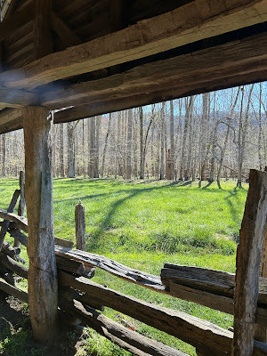
Iguazú National Park– The Iguazú National Park is a national park of Argentina, located in the Iguazú Department, in the north of the province of Misiones, Argentine Mesopotamia. It has an area of 677 km².
El Ateneo Grand Slendid– El Ateneo Grand Splendid is a bookshop in Buenos Aires, Argentina. In 2008, The Guardian placed it as the second most beautiful bookshop in the world. In 2019, it was named the \”world\’s most beautiful bookstore\” by the National Geographic.

MALBA– The Latin American Art Museum of Buenos Aires is a museum located on Figueroa Alcorta Avenue, in the Palermo section of Buenos Aires. Created by Argentine businessman Eduardo Costantini, the museum is operated by the not-for-profit Fundación MALBA – Costantini, and was inaugurated on September 21, 2001. The institution was organized around the Costantini Collection, and has continued to expand its selection of works from modern artists across Latin America. It also maintains a cultural center, which stages art and film exhibitions and develops cultural activities. The museum receives over a million visitors annually, and is sustained by over 1,400 active patrons. The museum design was made through an open call contest.; 450 proposals from 45 countries were presented. The selection was made by an international jury of architects, and the first prize was awarded to three young Argentinian architects: Gaston Atelman, Martin Fourcade and Alfredo Tapia. The building project was executed by AFT Architects, an Argentine architectural firm. The mission of the MALBA is to collect, preserve, research and promote Latin American art from the onset of the 20th century to the present.
Caminito– Caminito is a street museum and a traditional alley, located in La Boca, a neighborhood of Buenos Aires, Argentina. The place acquired cultural significance because it inspired the music for the famous tango \”Caminito\”, composed by Juan de Dios Filiberto.
Quebrada De Humahuaca– The Quebrada de Humahuaca is a narrow mountain valley located in the province of Jujuy in northwest Argentina, 1,649 km north of Buenos Aires. It is about 155 km long, oriented north-south, bordered by the Altiplano in the west and north, by the Sub-Andean hills in the east, and by the warm valleys in the south. The name quebrada translates as a deep valley or ravine. It receives its name from Humahuaca, a small city of 11,000 inhabitants. The Grande River, which is dry in winter, flows copiously through the Quebrada in the summer. The region has always been a crossroads for economic, social and cultural communication. It has been populated for at least 10,000 years, since the settlement of the first hunter-gatherers, which is evidenced by substantial prehistoric remains. In particular, many stone-walled agricultural terraces, thought to originate more than 1500 years ago, are found throughout the region and are still in use today. The field system links a series of fortified towns called pucaras.
National Park: Los Alerces– Los Alerces National Park is located in the Andes in Chubut Province in the Patagonian region of Argentina. Its western boundary coincides with the Chilean border. Successive glaciations have molded the landscape in the region creating spectacular features such as moraines, glacial cirques and clear-water lakes. The vegetation is dominated by dense temperate forests, which give way to alpine meadows higher up under the rocky Andean peaks. A highly distinctive and emblematic feature is its alerce forest; the globally threatened alerce tree is the second longest living tree species in the world. The alerce forests in the park are in an excellent state of conservation. The property is vital for the protection of some of the last portions of continuous Patagonian Forest in an almost pristine state and is the habitat for a number of endemic and threatened species of flora and fauna.

Woman\’s Bridge– Puente de la Mujer, is a rotating footbridge for Dock 3 of the Puerto Madero commercial district of Buenos Aires, Argentina. It is of the cantilever spar cable-stayed bridge type and is also a swing bridge, but somewhat unusual in its asymmetrical arrangement. It has a single mast with cables suspending a portion of the bridge which rotates 90 degrees in order to allow water traffic to pass. When it swings to allow watercraft passage, the far end comes to a resting point on a stabilizing pylon.
Lanín– Lanín is an ice-clad, cone-shaped stratovolcano on the border of Argentina and Chile. It forms part of two national parks: Lanín in Argentina and Villarrica in Chile. It is a symbol of the Argentine province of Neuquén, being part of its flag and its anthem. Although the date of its last eruption is not known, it is estimated to have occurred within the last 10,000 years. Following the 1906 Valparaíso earthquake a local newspaper reported the volcano to have erupted, but a work published in 1917 by Karl Sapper disputed this. The ascent is regulated by the management of Argentine National Parks and the Argentine National Gendarmerie and is technically relatively simple but has a much higher level of exposure than the neighbouring volcanoes. The nearest towns, usually employed as a base for climbers, are Pucón in Chile and Junín de los Andes in Argentina. There are two paths to the summit: one on the north, starting at 1,200 metres above mean sea level near Tromen Lake and the international Mamuil Malal Pass, accessible via Neuquén\’s Provincial Route 60; and one on the south, starting beside Huechulafquen Lake, accessible via Provincial Route 61.
National Park: Nahuel Huapi– Nahuel Huapi National Park is the oldest national park in Argentina, established in 1934. It surrounds Nahuel Huapi Lake in the foothills of the Patagonian Andes. The largest of the national parks in the region, it has an area of 7,050 km², or nearly 2 million acres. Its landscapes represent the north Patagonian Andean Zone consisting of three types, namely, the Altoandino, the Andino-Patagónico and the Patagonian steppe. It also represents small parts of the Valdivian Rainforest. The park and the reserve lie at an altitude of 720–3,574 metres, and are designated under IUCN management categories II and IV. The park is completely protected while the reserve is partially protected. The national park is dominated by the high mountain chain of the Andes, many lakes, rapid rivers, waterfalls, snow-clad peaks, glaciers and extensive forests. It is bordered by Chile on its western side.
Salinas Grandes– The Salinas Grandes are located in the north west part of Argentina, in the provinces of Jujuy and Salta, at an average altitude of 3450 meters above sea level. It covers an area of 212 km² and is well-known for its vast white desert.
Cañon Del Atuel– The Atuel Canyon is a narrow canyon and popular tourist attraction within Valle Grande, Argentina. The canyon is popular location for adventure sports, including river rafting, hiking, climbing, horse riding and mountain biking. The Atuel River flows through the base of the canyon and contains several rapids, which are used for rafting and canoeing. Those rapids are classified between class II and IV in the International Scale of River Difficulty. The surrounding area includes many hotels, camping sites, country clubs and other lodging facilities.
Torres del Paine Nationa Park– Torres del Paine National Park is a national park encompassing mountains, glaciers, lakes, and rivers in southern Chilean Patagonia. The Cordillera del Paine is the centerpiece of the park. It lies in a transition area between the Magellanic subpolar forests and the Patagonian Steppes. The park is located 112 km north of Puerto Natales and 312 km north of Punta Arenas. The park borders Bernardo O\’Higgins National Park to the west and the Los Glaciares National Park to the north in Argentine territory. Paine means \”blue\” in the native Tehuelche language and is pronounced PIE-nay, while Torres means \”towers\”. Torres del Paine National Park is part of the Sistema Nacional de Áreas Silvestres Protegidas del Estado de Chile. In 2013, it measured approximately 181,414 hectares. It is one of the largest and most visited parks in Chile. The park averages around 252,000 visitors a year, of which 54% are foreign tourists, who come from many countries all over the world. It is also part of the End of the World Route, a tourist scenic route. The park is one of the 11 protected areas of the Magallanes Region and Chilean Antarctica.

Iguazu Falls– Iguazú Falls or Iguaçu Falls are waterfalls of the Iguazu River on the border of the Argentine province of Misiones and the Brazilian state of Paraná. Together, they make up the largest waterfall in the world. The falls divide the river into the upper and lower Iguazu. The Iguazu River rises near the heart of the city of Curitiba. For most of its course, the river flows through Brazil; however, most of the falls are on the Argentine side. Below its confluence with the San Antonio River, the Iguazu River forms the border between Argentina and Brazil. The name Iguazú comes from the Guarani or Tupi words \”y\”, meaning \”water\”, and \”ûasú \”, meaning \”big\”. Legend has it that a deity planned to marry a beautiful woman named Naipí, who fled with her mortal lover Tarobá in a canoe. In a rage, the deity sliced the river, creating the waterfalls and condemning the lovers to an eternal fall. The first European to record the existence of the falls was the Spanish Conquistador Álvar Núñez Cabeza de Vaca in 1541.

Hope you enjoyed the post. Thanks for read it.
Email: staceplores@gmail.com
(Travel & Tourism Specialist)